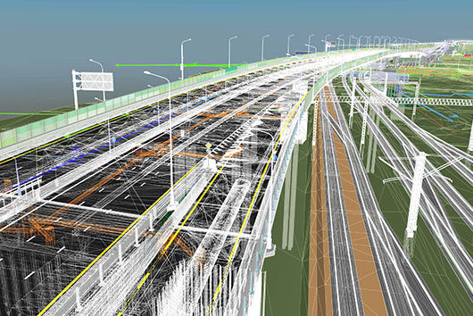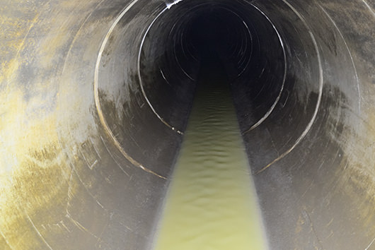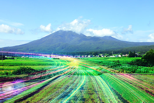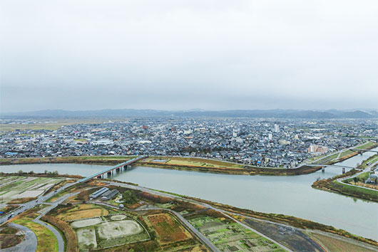

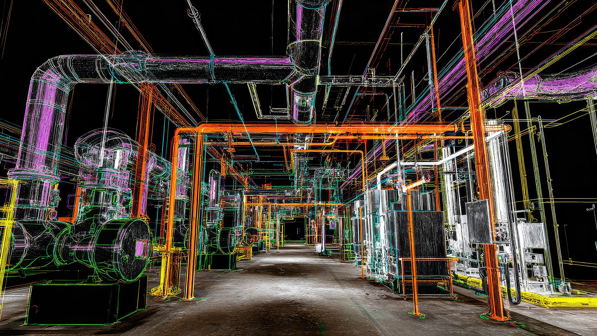
The utilization of point cloud, which represents objects and terrain in three-dimensional space with countless points, is advancing and playing a significant role in the design, construction, and maintenance of infrastructure structures. More recently, advancements in point cloud data processing technology have opened up new avenues for applications, attracting attention as a way to make the increasingly promising concept of digital twins more accessible. We talked o Akihiko YAMANAKA and Kazuto KOMATSUBARA from Advanced Technology Center of PACIFIC CONSULTANTS, who are advancing technology development related to the utilization of point cloud data.
INDEX
- What is point cloud data?
- The utilization of expanding point cloud data
- Point cloud data is an essential foundational technology for digital twins
- Challenges in utilization of point cloud data
- PACIFIC CONSULTANTS' initiatives
- Towards the practical application of digital twins utilizing point cloud data
What is point cloud data?
Point cloud data is three-dimensional digital data that represents the surface of an object or space as a collection of numerous points. It is mainly acquired by using 3D laser scanners installed on the ground or aerial laser surveying. Each point has X, Y, and Z coordinates and can also contain information about color and reflectivity. By arranging countless points in three-dimensional space, three-dimensional objects, spaces, and terrains can be reproduced with high accuracy. Not only can the distance between objects be measured accurately, but it can also be viewed from any angle (360 degrees) and cross-sections can be cut at any point.
Furthermore, while point cloud data is simply a collection of random points, by connecting these points to create surfaces and providing shape information, it can be converted into 3D modeling data that can then be used in BIM/CIM or to create 2D drawings.
The utilization of expanding point cloud data
Point cloud data is utilized in design, construction, and maintenance for highly accurate measurements down to the millimeter, checking the surface condition of roads, tunnels, and bridges, and for identifying subtle changes and diagnosing deterioration by comparing the same location over time. It is also used for detailed documentation of cultural properties such as historical buildings, Buddhist statues, and works of art, and for considering restoration plans.
Furthermore, point cloud data acquired by drones and UAVs (Unmanned Aerial Vehicles) contains absolute coordinate information (latitude and longitude) through integration with GPS. Data acquired by ground-based measuring instruments can also incorporate coordinate information by using reference points. Because this point cloud data with absolute coordinates can be combined with GIS (Geographic Information System), overlaying it with GIS information such as topographic maps, aerial photographs, roads, and infrastructure structures reveals the environment in which an area exists, its current state, and its deterioration over time. Land uplift and movement, as well as forest growth, can also be understood. Even in cases of large-scale disasters where on-site access is difficult, comparing point cloud data obtained from the air before and after the disaster allows for a better understanding of the situation, which can be useful in considering recovery policies and priorities.
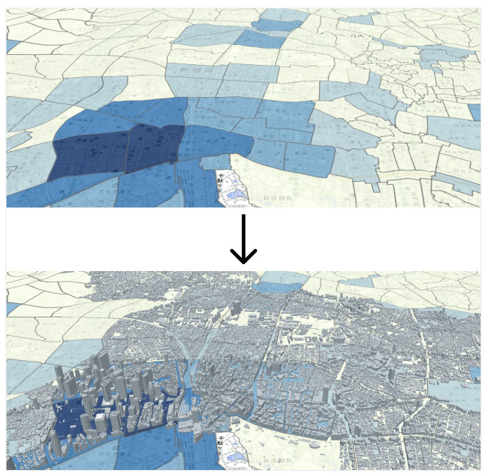
Source: What you can do with 3D city models [1/2] (PLATEAU by MLIT)
Point cloud data is an essential foundational technology for digital twins
The utilization of point cloud data is attracting attention not only in civil engineering, architecture, and disaster response. The point cloud is also extremely important as a foundational technology for digital twins which are necessary when considering and making decisions regarding future urban development, transportation planning, infrastructure, logistics, and manufacturing technologies. This is because the point cloud data is a powerful foundational technology that can reproduce complex shapes and wide-area spaces with high accuracy and efficiency, which was difficult with conventional measurement methods.
Digital twins are not merely rudimentary representations of spaces used in typical walkthrough experiences. They digitally recreate a realistic world that reflects not only millimeter-level dimensional accuracy but also the various elements that make up the space. They enable prediction and simulation of changes, supporting decision-making. The point cloud data is what makes it possible to recreate such a highly accurate space.
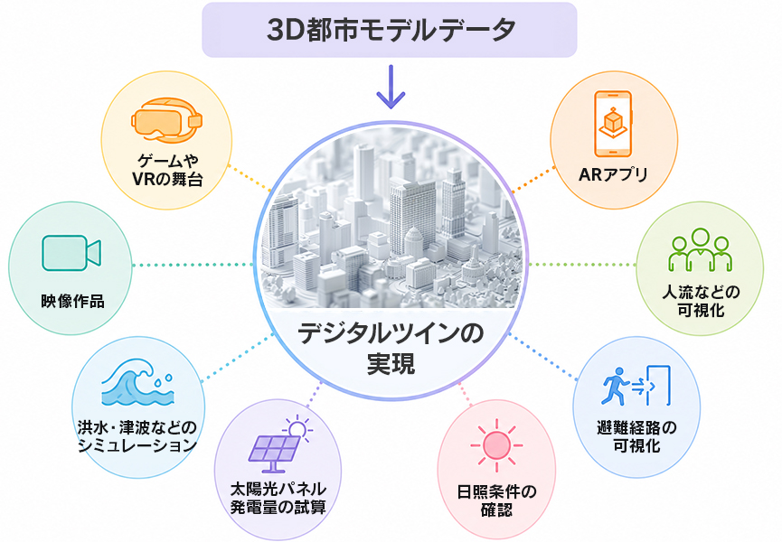
Created by our company based on existing materials.
Source: What you can do with 3D city model [1/2] (PLATEAU by MLIT)
Challenges in utilization of point cloud data
However, the use of point cloud data has not become widespread. Currently, there are two main ways to utilize point cloud data. One is to use it as measurement data as is, and the other is to convert it into 3D modeling data. In practical terms, it is pretty much limited to these two methods.
Why isn't its use more widespread? ~ A major reason is the sheer volume of point cloud data. This large data volume, which is both a characteristic and an attractive feature of point cloud, makes further utilization difficult.
In reality, point cloud data contains millions to hundreds of millions of points, each with its own attribute data. Since a single structure is represented as a collection of these points, the amount of data is enormous, ranging from hundreds of MB for small sites to tens of GB for larger ones. Handling and rendering this much data without stress requires a high-spec computer, and saving, transferring, and sharing the data requires large-capacity storage and a high-speed communication environment. Furthermore, acquiring point cloud data using laser scanners is costly, and pre-processing such as noise reduction is essential for utilizing the acquired data. Converting it into 3D modeling data is also time-consuming and costly. As a result, while there is much talk about the potential of point cloud data, its actual utilization is not progressing as quickly as expected.
If we could easily manipulate point cloud while maintaining its rich information content, the scope of utilization of point cloud data would expand even further, bringing us much closer to the world of digital twins.
PACIFIC CONSULTANTS' Initiatives
The "3D Point Cloud Equipment Maintenance and Management Platform System," developed by PACIFIC CONSULTANTS and currently undergoing trial operation, is a new system for utilizing point cloud and brings us one step closer to digital twins.
Large-scale facilities known as plants, which produce essential products and energy that support industry, such as sewage treatment plants, waste disposal facilities, power plants, oil refineries, steel mills, and large-scale petrochemical manufacturing plants, operate 24 hours a day without interruption, with multiple pieces of equipment with different functions working in a complex combination.
Currently, maintaining and managing these facilities are becoming extremely difficult due to factors such as aging equipment, personnel shortages, and a decline in experienced engineers. Therefore, efficiency improvements, labor savings, and the transfer of technical skills are urgent issues.
The development of a new maintenance and management platform system based on point cloud data was considered as a way to help solve these problems.
The following four concepts were the basis for the development:
① To reduce the processing costs and effort involved in creating 3D modeling data, point cloud data is imported into the system without any processing.
② Generally, facility equipment ledgers are managed separately using Excel or 2D drawings, but the new system to be developed will allow for the identification of location information using 3D point cloud and enable centralized management as a ledger system linked to maintenance-management information.
③ By leveraging the fact that the facility's base map is a point cloud, it can be used as a support tool for renovation design, such as examining material delivery routes and installation spaces for equipment renovations.
④ As maintenance-management information that can be traced back from the platform system, for example, specific work videos will be linked, transforming the tacit knowledge of experienced skilled technicians into explicit knowledge that anyone can access on the system. Furthermore, by linking AI cameras and measurement sensors to location information, remote monitoring will be made possible, enabling the development of advanced maintenance technology and addressing future shortages of technicians.
The "3D Point Cloud Equipment Maintenance-Management Platform System" was developed based on four core concepts. By utilizing point cloud data without processing it and linking it with equipment ledgers, maintenance-management information, and work videos, it enables centralized management of the entire facility. Furthermore, the proprietary technology supporting this system has been granted an international patent. Demonstrations conducted for facility managers have received a great deal of positive feedback, with comments such as "I can't believe this is point cloud data" and "I can't believe it moves this fast despite being point cloud data."
Towards the practical application of digital twins utilizing point cloud data
PACIFIC CONSULTANTS is currently piloting its newly developed 3D point cloud equipment maintenance-management platform system for maintenance-management work at wastewater treatment plants under its contract. While continuously improving the system during operation, the company is also exploring its potential application to other wastewater treatment plants, as well as large-scale manufacturing and energy plants. Furthermore, having obtained patents for the same technology in Indonesia, China, and the United States, the company is considering expanding its operations overseas.
Digital twins are an indispensable tool for solving the various challenges facing cities today and for realizing future urban models. PACIFIC CONSULTANTS is promoting the introduction of its 3D point cloud equipment maintenance-management platform system to plants both domestically and internationally, and through the advancement of digital twins utilizing point cloud data technology, it will continue to move forward toward realizing its vision of "Producing the Future."